Twisk to Shek Lung Kung
Recommended Route
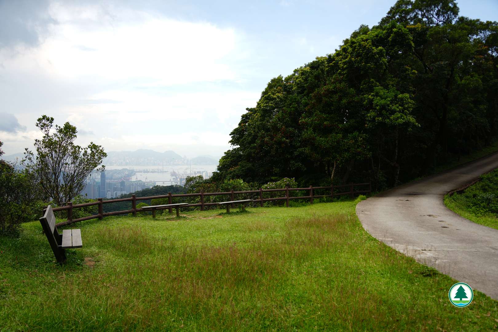
Starting from Tai Lam Forest Track next to the Twisk Campsite, the route gently ascends for 1.5km before reaching an open resting area, where you can enjoy distant views of Tai Mo Shan and Tsuen Wan.
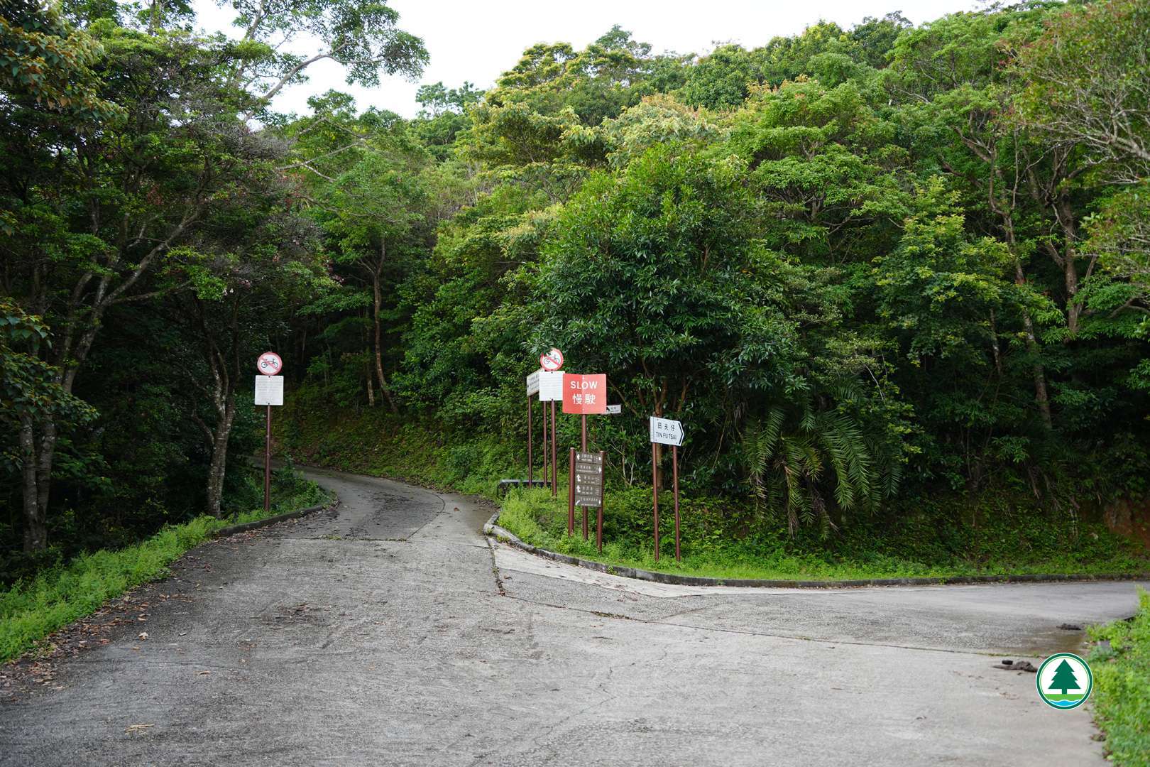
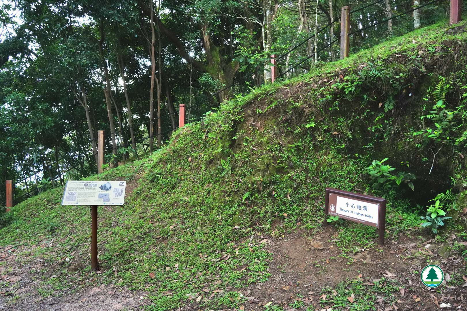
Continue along the Tai Lam Forest Track until you reach a fork, then take “Tai Lam Forest Track - Lin Fa Shan Section” on the left. This section is shaded and quite gentle. If you look carefully along the way, you may spot some small pits on the hillside that do not appear to be natural. In fact, Lin Fa Shan and Sheung Tong were once a key area for extracting wolframite in the New Territories in the 1950s to 1960s. During the period, the demand and price of wolframite skyrocketed, earning it the nickname “black gold”. Apart from professional mining companies, this also sparked a “gold rush”. Many locals flocked to the area hoping to get a share using simple tools, such as pickaxe and chisel. Some traces of the mining activities in the past remain in the woods today. For safety, please do not trespass, enter or get close to the abandoned shafts.
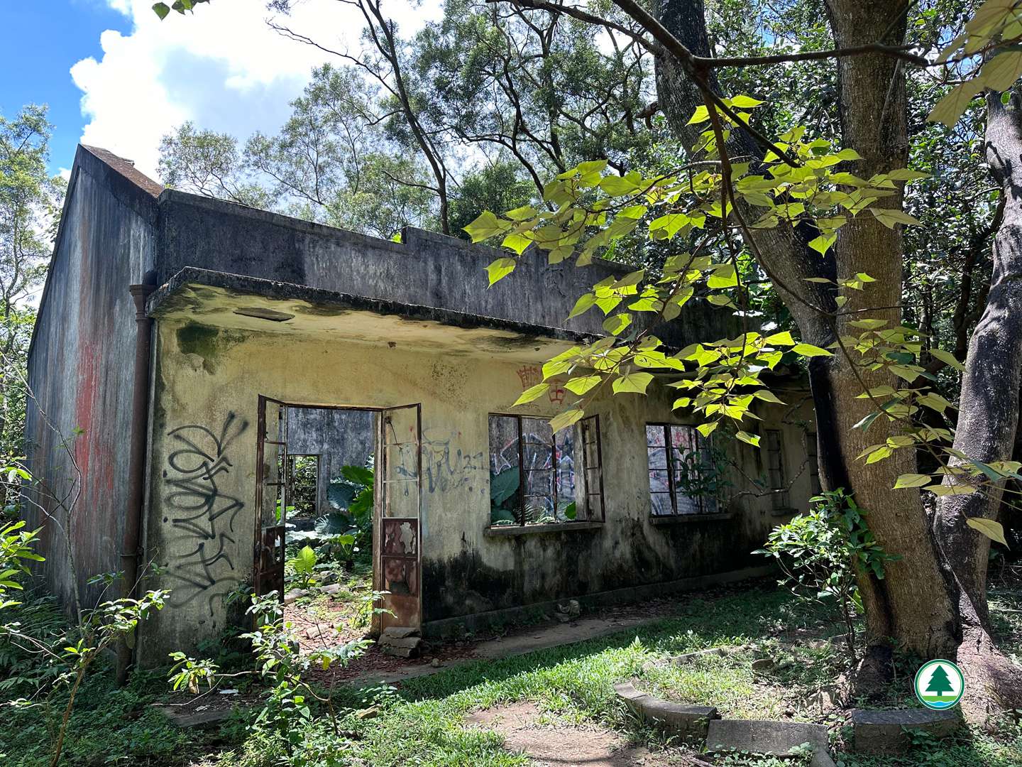
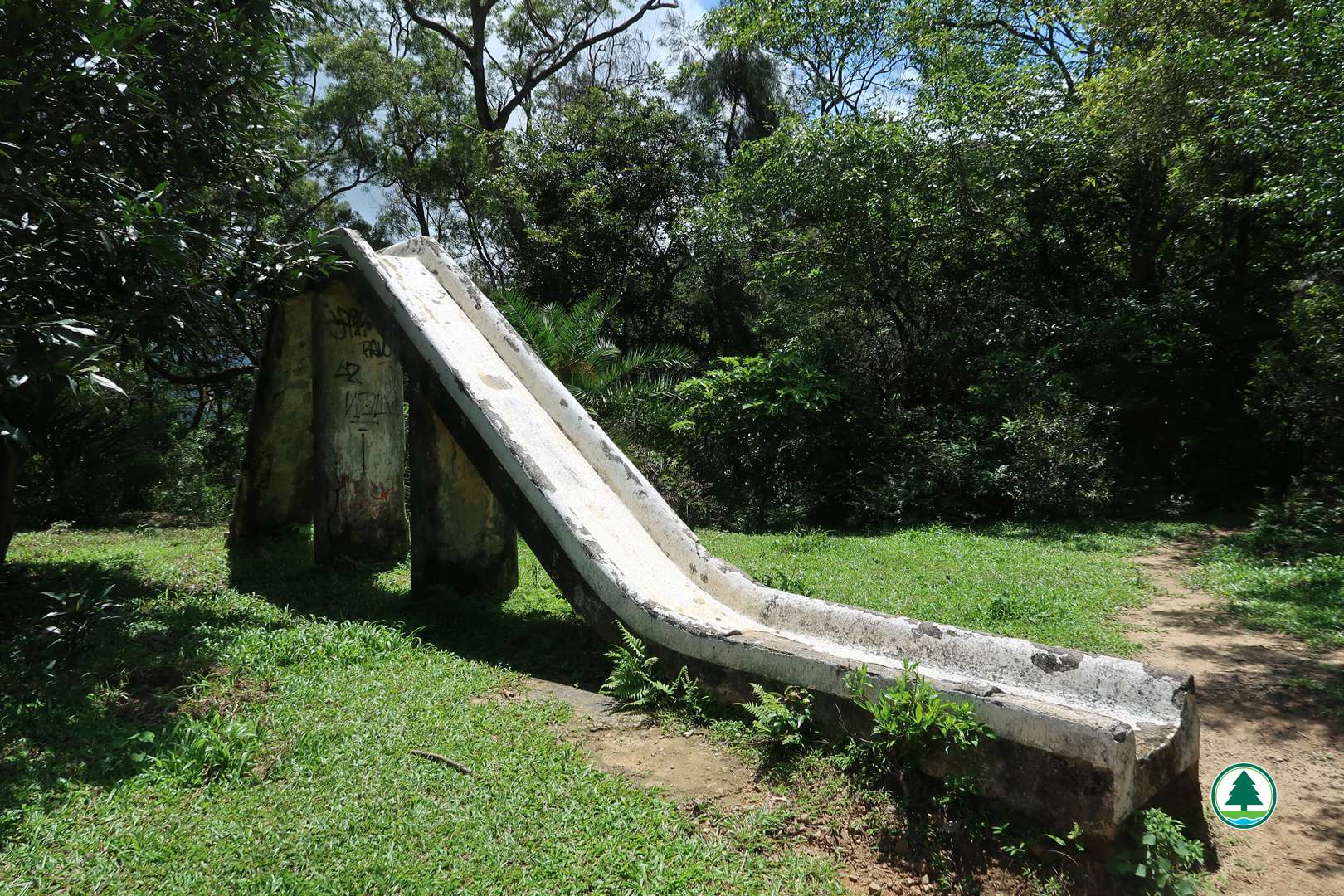
Head downhill for about 1 km and you will reach the Lin Fa Shan Public School. A white slide made with cement quietly stands at the side as if frozen in time. Children from nearby villages in Sheung Tong, Sheung Fa Shan and Ha Fa Shan attended the school until it closed down in the 1980s. The once-bustling school is now deserted, with only its dilapidated walls and scattered tiles remained.
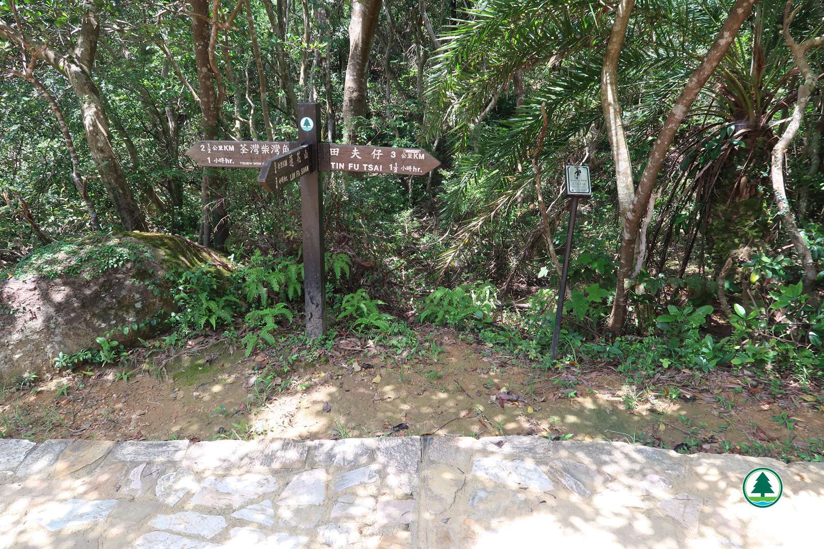
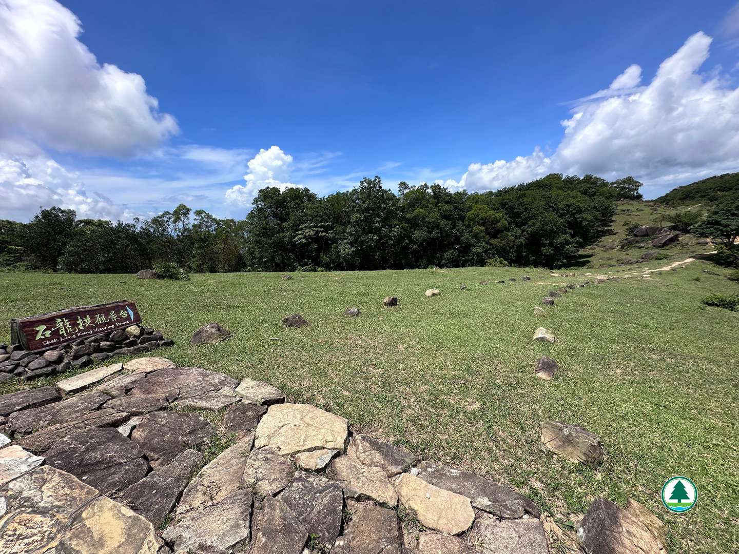
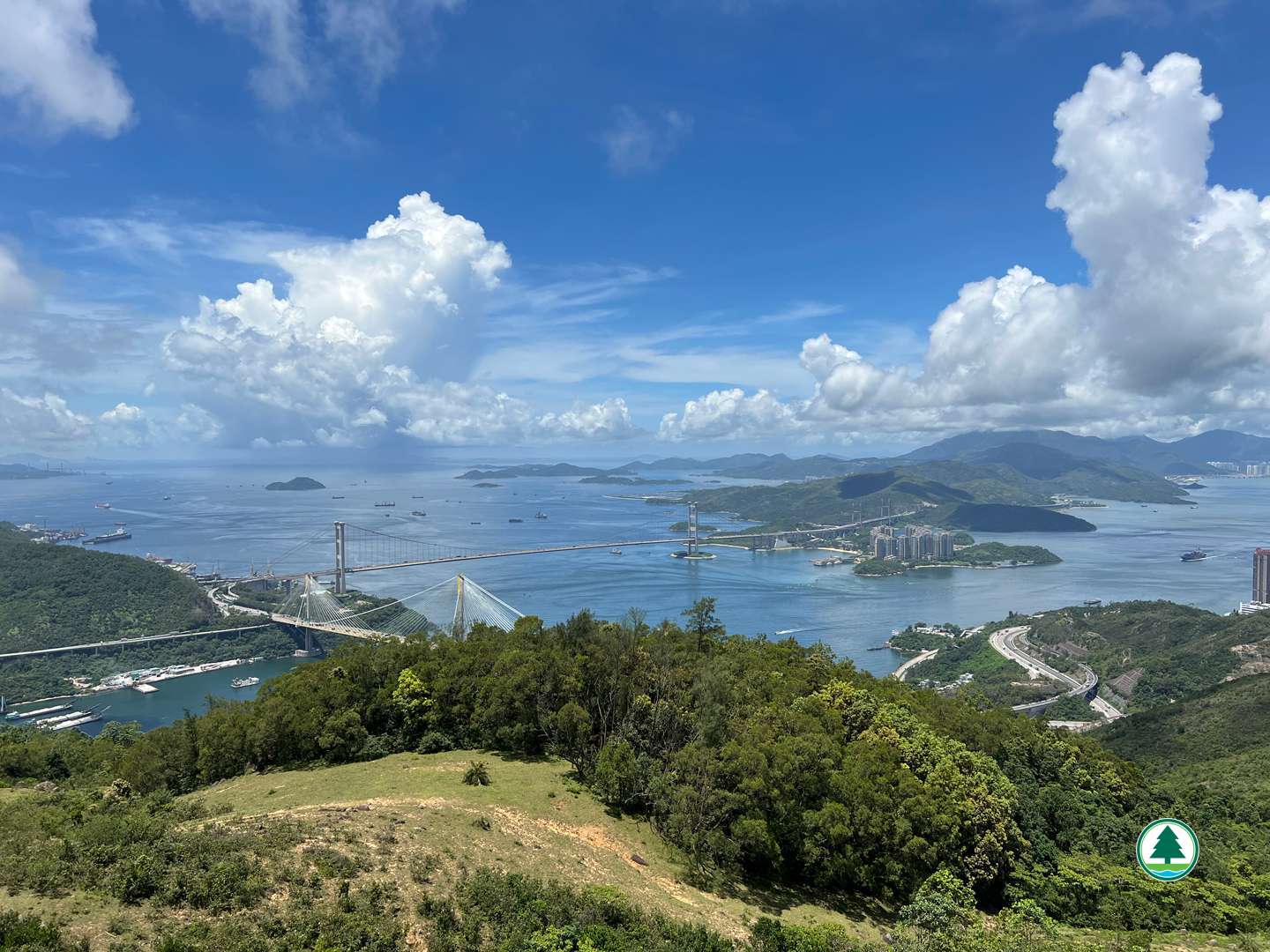
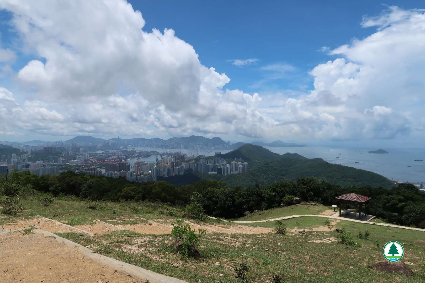
Continue downhill until you reach a fork, then follow the sign to turn left (to Tsuen Wan Chai Wan Kok) to go to Shek Lung Kung. As you proceed, you will see a sign indicating "Shek Lung Kung Viewing Point". Turn right and detour along the handcrafted trail for about 400 m to the viewing point. Located on a vantage point, the viewing point offers a breathtaking view where city meets the sea, overlooking the Rambler Channel, Tsing Ma Bridge, and Ting Kau Bridge. The view is definitely worth the detour. After enjoying the view, retrace your steps back to the main route, where you can have some rest at a pavilion not far away. Alternatively, walk up to the wooden benches up the slope to admire the scenery of Tsuen Wan and Tsing Yi.
After resting, return to the route and continue downhill. This section is steeper, so please be careful. Descend for about 1 km and cross the Tai Lam Chung Catchwater, go down the steps to reach the endpoint at Tsuen King Circuit.

To facilitate the public in planning their hikes, the geographical information of the route, including the route map, starting point, endpoint, and elevation chart, has been saved in a "GPX" file. The public can download hiking-related applications on their smartphones or smart watches, then click on the following "GPX" file to import the relevant information, which serves as an aid for hiking. Please note that downloading "GPX" files may increase data usage, and the functions and content display may vary depending on the device and application used.
Transportation Information
Starting Point
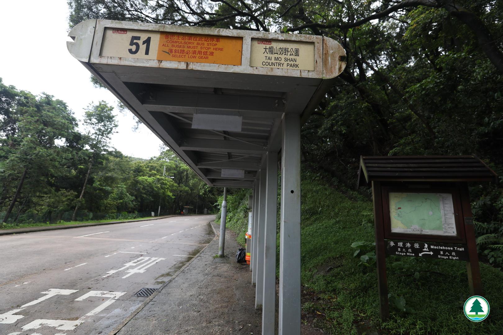
Take public transport to "Tai Mo Shan Country Park" bus stop. Head towards the direction of the rear of the bus to arrive at Tai Lam Forest Track – Twisk Section.
Kowloon Motor Bus (KMB) route - 51
Endpoint
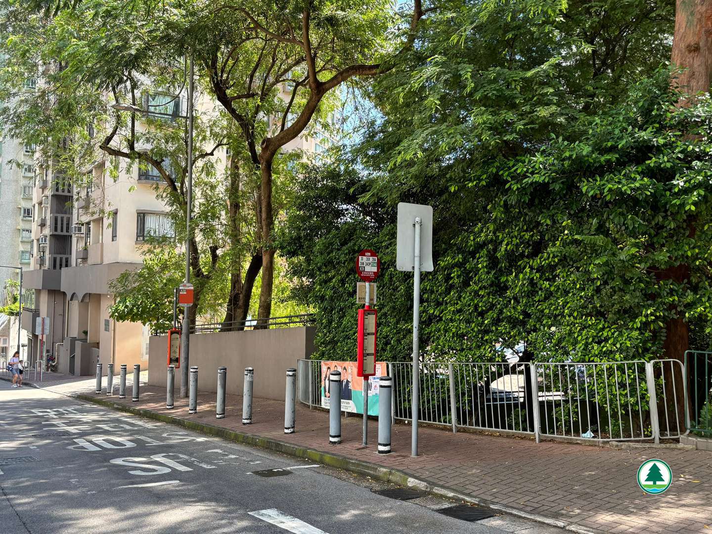
Take public transport at “Tsuen Wan Adventist Hospital” bus stop, or walk 20 minutes to Tseun Wan MTR station.
Kowloon Motor Bus (KMB) route - 39M, 30, 30X and 39A

The transportation information provided in this website is for reference only. Please check the updated transportation information from the websites of Transport Department and relevant transport utilities before setting off.
HKeMobility web page
https://www.hkemobility.gov.hk/
Route Map
The map below shows the route and scenic spots along the hiking trail.
For details, please refer to the transportation information above and photos below.
Gallery
Map showing the Twisk to Shek Lung Kung Recommended Route (Opposite Twisk Management Centre)
A resting area overlooking distant views of Tai Mo Shan and Tsuen Wan
Take the left path to “Tai Lam Forest Track – Lin Fa Shan Section”
Wolframite Mine Shaft
Lin Fa Shan Public School
A white slide made with cement at Lin Fa Shan Public School
Junction of the path leading to Shek Lung Kung
To Shek Lung Kung Viewing Point
Overlooking the Tsing Ma Bridge and Ting Kau Bridge from the Shek Lung Kung Viewing Point
Overlooking Tsuen Wan and Tsing Yi